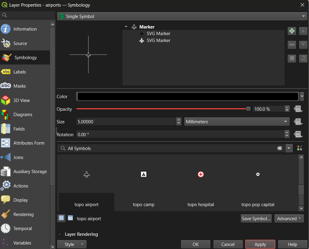
Image 1 of 1: ‘Screenshot of the QGIS Layer Properties dialog for the airports layer on the Symbology tab. Single Symbol is selected at the top, the marker is an airplane SVG symbol called topo airport, color is black, opacity 100 percent and size 5 millimeters. The symbol library below shows topo airport, topo camp, topo hospital and topo pop capital.’
Layer Properties, Symbology tab, with the topo
airport marker selected
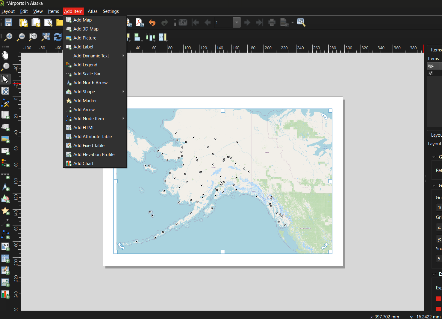
Figure 2
Image 1 of 1: ‘Screenshot of the QGIS Print Layout window titled Airports in Alaska. The Add Item menu is open, listing Add Map, Add 3D Map, Add Picture, Add Label, Add Dynamic Text, Add Legend, Add Scale Bar, Add North Arrow, Add Shape and other items. The page shows a map frame containing Alaska with airport symbols over an OpenStreetMap basemap.’
Print Layout with the Add Item menu open
Figure 3
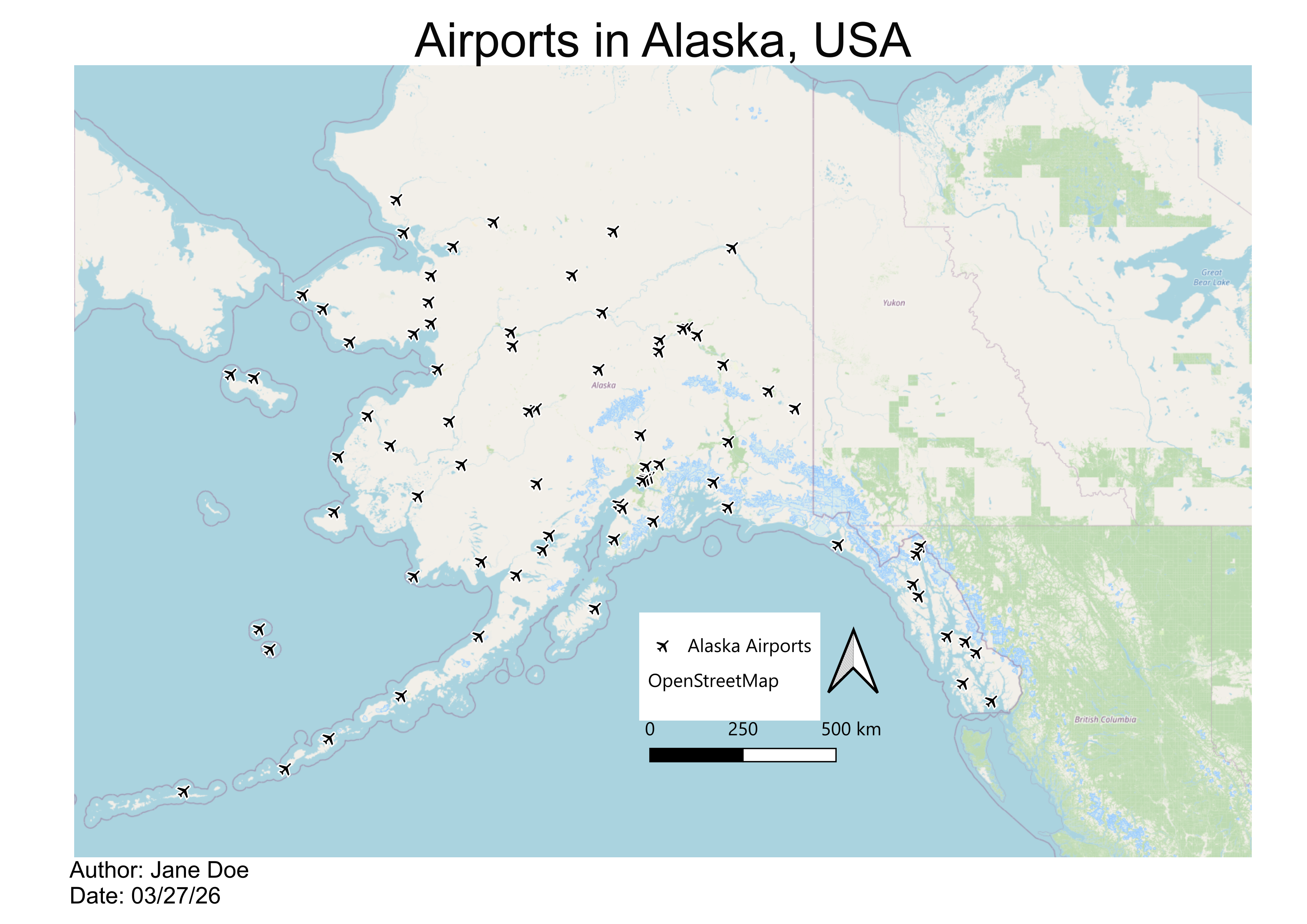
Image 1 of 1: ‘A finished QGIS map titled Airports in Alaska, USA. Black airplane symbols mark 76 airports across Alaska over an OpenStreetMap basemap that also shows western Canada. A legend lists Alaska Airports and OpenStreetMap, with a north arrow and a scale bar from 0 to 500 kilometers. Author and date appear below the map.’